Sunday, August 10, 2008
Sunday, August 3, 2008
The Edmund Niles Huyck Preserve: Rensselaerville Falls, Rensselaerville N.Y. Episode 1.
I started this blog the day after we did the Hike. We shot so many pictures that it has taken more time than usual to sort through them and post. This is how I started out last Monday:
...Just woke up... crashed on the couch after I got home from the hike and took a shower... Whata GEEZER!
...Just woke up... crashed on the couch after I got home from the hike and took a shower... Whata GEEZER!
~~
Lets face it, most people who hike the The Edmund Niles Huyck Preserve: Rensselaerville Falls just do the falls and thats all. I admit it. That was me. I've done the falls numerous times over the past few years. ...Relationships have begun and ended there... (There was this blonde once... but thats another story...)
~~
That having been said, There is much more to this preserve than just the falls, don't get me wrong, the falls are spectacular, and thats a good reason to go there, but there is so much more! There is so much more that between Adventure-bIRD~ and I we shot close to 300 pictures, and the short hike we intended to take became an afternoon into evening journey. Be that as it may, this blog may be broken up into more than one entry. The second and for me the most Picturesque will come soon at a later date when I finish choosing from the vast amount of photos.
~~
~~
The Edmund Niles Huyck Preserve is also a Biological Research Station. Actually, it is one of the oldest Biological Research Station in the nation and was established in 1931. The preserve is a member of the OBFS and you can learn more about this by following this link: Organization of Biological Research Stations. It is also the host station for the IOBFS.
~~
First off, the Rensselaerville Falls. We entered at the main entrance-way from Livingston Ave., or County Route 353 from Rensselaerville. Rensselaerville, has been referred to as a town that time forgot. It is the home of many Artists and Writers who have moved here for just that reason. Its most famous resident is Andy Rooney. But thats not why your here....
The Memorial Plaque at the entrance to the parking lot.
(Map Location #1-a)
(Map Location #1-a)
Edmund Niles Huyck died in 1930. In 1931, his wife, Jessie Van Antwerp Huyck, founded the Edmund Niles Huyck Nature Preserve in his memory with the forward-looking mission of preserving the watershed of Lake Myosotis, Rensselaerville’s water supply, located at the edge of the Huyck estate.
~~
The Gazebo in the parking lot is under renovation now and the parking lot is limited to about ten cars at this point. There is a large Events-Board at the entrance noting the many programs that take place here over the course of the summer, but a site specific map is conspicuously absent. There is also a lack of a sign-in board to let anyone know that you have entered the trail and what your hiking intentions are. Not good. Many is the hiker who has fallen and been located based on this simple information, provided that is, if you provide it.
Rules of Hiking engagement.
(#1-b)
(#1-b)
As you may have guessed the lower part if this preserve which consists of the Rensselaerville Falls is a popular high traffic site, partly because of its location in the very center of Rensselaerville and also because of its accessible spectacular natural beauty. Unfortunately because of its high traffic the ware on the trails and their vicinities are quite evident.
The trail map we obtained from the web site is not very detailed. Therefore I have taken the liberty of enlarging it to better suit my purposes.
The trail begins by following along the Ten Mile Creek up to the first bridge indicated on the map simply by a left angle over the creek.
The trail crosses at this point at what I will refer to as the Lower Falls. Adventure-bIRD~ and I took several views and found it hard to deal with the strong sunlight and reflections. Here are some of the results:
The trail map we obtained from the web site is not very detailed. Therefore I have taken the liberty of enlarging it to better suit my purposes.
The trail begins by following along the Ten Mile Creek up to the first bridge indicated on the map simply by a left angle over the creek.
The Lower Falls environs.
(Location #2-a)
(Location #2-a)
Trail terrain along the Creek bed.
(#2-b)
(#2-b)
The trail crosses at this point at what I will refer to as the Lower Falls. Adventure-bIRD~ and I took several views and found it hard to deal with the strong sunlight and reflections. Here are some of the results:
I decided to ignore the Rules of Hiking Engagement
in the name of Artistic License
and Adventure-bIRD~ caught me in the act....
(#2-c)
(#2-c)
Adventure-bIRD~ crosses over the bridge.
(Map Location # 3-a)
A closer look at the bridge.
(#3-b)
(#3-b)
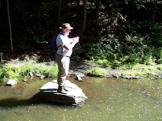
I of course crossed under the bridge.
Look closely and you will see the bIRD
along the opposite bank.
(#3-d)
This is the best shot I got from this location.
(#3-e)
bIRD tries his best from his side of the Creek bed.
(#3-f)
I do my best from my side...
"Ahhh.. the light... it buuurns!"
(#3-g)
Eventually we gave up and climbed back to the trail. After you cross the bridge you come to the site of the Huyck Felt Paper Mill. Here is a plaque celebrating the 100th year of the Huycks Corporation in September of 1970.
Memorial Plaque, at site of Felt Mill.
(#3-h)
(#3-h)
A Close up of plaque.
(#3-i)
At this point I ran into a family of friends from V'ville who were just coming down from their hike along the falls. They recommended a location for a future hike that may show up here if I can ever remember the name and location. I hope I remember to ask the next time I run into them at the Supermarket.
obee-hikin-dude~ chats with a friend.
(#3-j)
(#3-j)
At this point the bIRD got all Artsy Fartsy on me and managed some really nice close up shots seen here:
Close up of Dragonfly. bIRD~ said that he tried several times
to get it to open its wings but was unsucessful in doing do.
(#4-a)
(#4-a)
Watershed masterwork.
(#4-b)
(#4-b)
Found Art by Adventure-bIRD~.
(#4-c)
There is a side trail along this side of the Lower Falls that is not indicated on the map that affords some better views:
The Lower Falls side trail.
(#4-d)
Just to prove that I can get Artsy-Fartsy I climbed down along the Falls and bIRD~ caught me in the act again:
Me being foolish for my Art.
(#4-e)
I decided to play around with the motion feature on my camera and here are some of the results:
(#4-f)
(#4-f)
(#4-g)
(#4-h)
Then I messed with the close-up function....
I was really more intrigued with
the petal-less flower-heads than the one remaining flower.
It wouldn't have been half as interesting
without that one remaining though.
(#4-i)
I have been known to do almost
anything for a shot.
Again, bIRD catches me in the act...
(#4-j)
This was the result. Maybe not worth the effort
involved in getting my old bones back up off the path.
I was interested in the crooked tree up above me,
but its shape and real beauty evaded me
and my camera this time I think.
(#4-k)
We returned to the quest at hand and proceeded up the path through old growth forest and along a diagonal incline to the switchback that leads to the Upper Falls Area:
bIRD leads the way uphill.
(#5-a)
Some of the trees along the path towards the switchback.
(#5-b)
Looking back down the hill towards the area of
the Lower Falls at the old growth forest.
(#5-c)
Again looking uphill to the switchback.
(#5-d)
At this point on the map there is a trail not indicated on the original map (Map Location #6) that runs back to the rear parking lot of the Co-op and Post Office. It would seem to be used to enter the preserve with the intent of going directly to the Upper Falls and the Lake Trail.
The signpost at the switchback.
(#7-a)
bIRD's hat takes a rest on the trail post.
(#7-b)
As we proceeded along the trail we frequently came across numbered stations in varying degrees of disrepair. Obviously at one point these signs must have accompanied a trail guide. Each one we came across began to make us wonder more what we might be missing by this neglect.
Propped up and neglected.
(#8-a)
We came upon these mushrooms popping up
from the decomposing fallen leaf covered ground.
Lack of light would seem to allow only this type of growth here.
(#8-b)
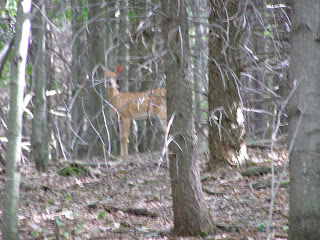
We were taken be surprise while we were concentrating
on the Mushrooms, when these Yearling's bounded by.
I was trying to use my close-up function and got only one
on the Mushrooms, when these Yearling's bounded by.
I was trying to use my close-up function and got only one
photo of a yearling darting behind a tree which I have
edited out. Adventure-bIRD~ managed this slightly out
of focus shot, as we were being checked out:
edited out. Adventure-bIRD~ managed this slightly out
of focus shot, as we were being checked out:
"Why those dumb humans were staring at those silly mushrooms?"
(#8-c)
The path to the Upper Falls covered with last years fallen leaves.
(#9-a)
At this point my camera battery died. bIRD~ passed his camera over to me and I persevered to continue photographing while learning the intricacies of someone else's camera under pressure. ;)
The directions to the falls or the Lake trail.
(#10-a)
At the Upper Falls we encountered this sign post.
The other side of the same post with a more detailed sign.
(#10-b)
(Map Location #11-a the Upper Falls Bridge.)
Just downhill from the sign post you reach the Upper Bridge over the falls. When you cross over this bridge the trail meets with the Lake trail returning from the Lake/Pond hike. From that point the trail proceeds down hill to the road and along the streets of Rensselaerville to the Preserve parking lot.
Ten Mile Creek as it approaches the Upper Falls Bridge.
(#11-b)
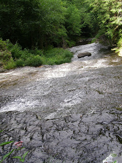
The Upper Falls from the Upper Bridge.
(#11-b)
A view of the falls fist decent.
(#11-c)
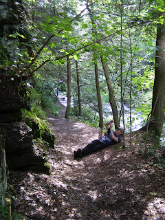
One of the frustrating things for me and also for Adventure-bIRD~ has always been the fact that there is no real look out point where one can view the Upper Falls. From previous hikes I was aware of a side trail. This is quite dangerous and I do not recommend it. I convinced bIRD to lay back while I broke the rules again and did the mountaineering thingie.
Yes BV, I climbed over this thing!
It looks somewhat like a Car Frame and I'm sure it was installed
to protect the water pipe that you can see running just under the steel bars.
(#12-a)
A view of the metal frame I crossed from the creek bank
after I scaled my way down to that point.
(STUPID obee-hikin-dúid~ !!! )
(#12-b)
The Spectacular View of the Upper Falls I was searching for.
(#13-a)
Looking downstream from the same spot.
(#13-b)
This would be a perfect place for the Huyck Preserve Foundation
to erect a viewing platform that would satisfy people
like bIRD and I desirous of a definitive view.
(#13-c)
This part of the Huyck Preserve is a short afternoon hike. Once you reach the top of the Falls you have the option of crossing the Upper Falls Bridge and walking down the streets back to the parking lot or returning by the way that you came. In episode 2 we will take you around the Myosotis Lake and Lincoln Pond. I was fascinated by the setting light so I took almost twice the pictures that I took along the Falls.
Overall Geezer Difficulty Rating:
Two and a half Geezers for the steep inclines and unkempt trails. It could have been higher if I included the silly mountaineering that I did and you won't! I took the dangerous views so you could see them and not have to risk your life. I am an experienced climber and you don't need to bring out the Hill towns Medivac Helicopter... Right?!!!
obee-hikin-dúid~10/Aug/08
Subscribe to:
Comments (Atom)


